
Some mountain roads inspire awe from a distance and dread from behind the wheel. The most notorious passes combine sheer drops, thin air, and weather that turns from postcard blue to whiteout in minutes, creating routes that even seasoned locals quietly avoid. These roads still pull in thrill seekers, but the people who live nearby often know better than to treat them as just another scenic drive.
Travelers now share dashcam clips, GPS tracks, and shaky phone videos that reveal how quickly beauty can turn to danger on these routes. The result is a new kind of folklore, where hairpin turns and missing guardrails become as famous as any summit, and where the bravest drivers learn to respect the same passes that residents approach with caution or skip entirely.
Colorado’s San Juan gauntlet
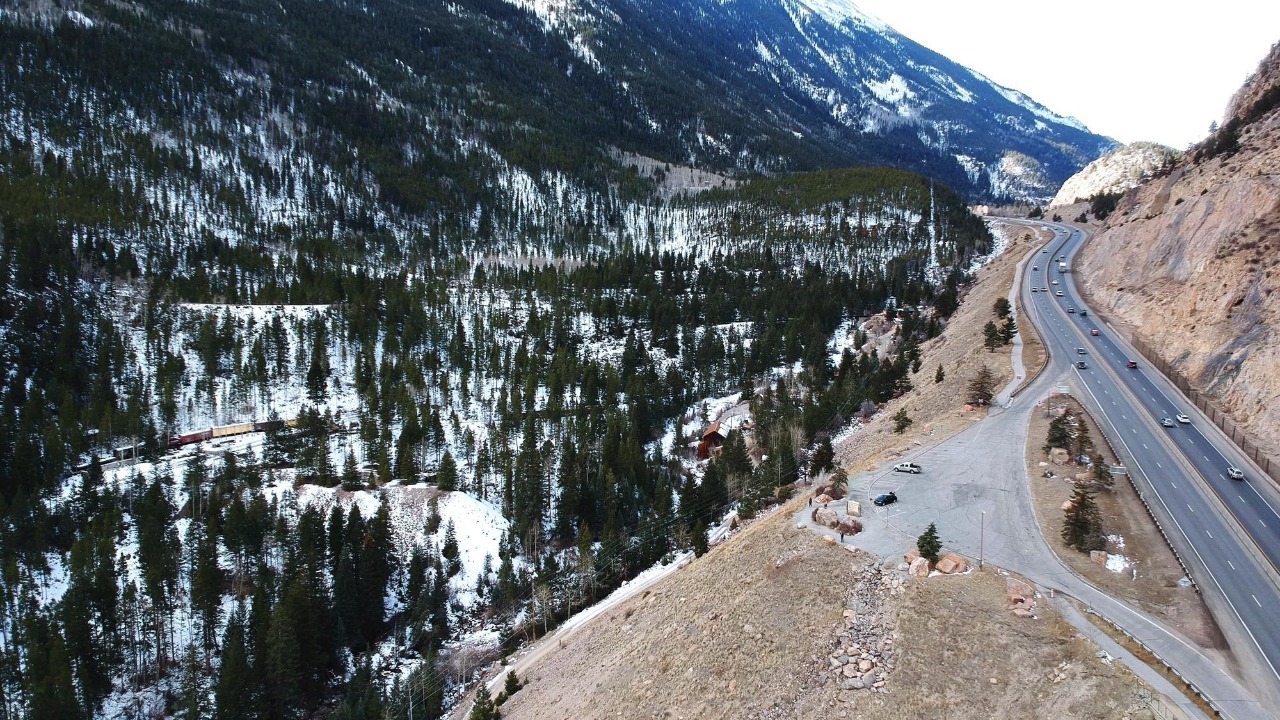
Western Colorado concentrates some of the most intimidating paved and dirt passes in North America. The San Juan Mountains rise in abrupt walls, so engineers carved roads into cliffs rather than across gentle ridges, leaving drivers to thread narrow ledges with thousand foot drops only a few feet from their tires. Locals in towns like Ouray and Silverton often plan errands and commutes around these routes, timing crossings for daylight and clear skies or avoiding them in winter altogether.
The stretch of US Highway 550 known as the Million Dollar Highway illustrates that uneasy balance between necessity and fear. Residents rely on this link between Ouray and Silverton, yet many warn visitors that the combination of steep grades, tight curves, and minimal shoulders can overwhelm drivers who expect a typical state highway. Online discussions about treacherous roads in Colorado often single out the Million Dollar Highway, with one traveler advising others to avoid it when Leaving Ouray toward the highest section, where exposure and drop offs intensify.
Red Mountain Pass and Black Bear’s brutal switchbacks
Red Mountain Pass sits at the heart of that same corridor and magnifies its hazards. Drivers cresting this summit face a mix of steep inclines, blind corners, and a roadway that often lacks guardrails along its most exposed stretches. Locals describe the route as a place where concentration cannot lapse, and where snow or ice can turn a routine crossing into a white knuckle ordeal that even experienced mountain residents prefer to postpone.
Travel guides now state plainly that, Yes, Red Mountain Pass ranks among the most dangerous roads in the United States because of those steep grades, sharp curves, and missing barriers. South and west of there, Black Bear Pass raises the stakes further, trading pavement for rock and gravel. Social media posts describe how the route, Carved into the San Juan Mountains of Colorado, funnels vehicles down a staircase of switchbacks that leave zero room for error. Many locals in nearby Telluride and Silverton treat Black Bear as a once in a lifetime challenge, not a regular route, and some never attempt it at all.
Where tourists see a bucket list, locals see a trap
Mountain communities often depend on tourism, yet residents know that some roads function more as adrenaline attractions than practical links. Visitors arrive with rental SUVs and smartphone maps, eager to tick off famous passes, while locals weigh avalanche forecasts, rockfall patterns, and the limits of their own vehicles. That gap in experience can turn a scenic drive into a rescue call for underprepared travelers who underestimate altitude, fatigue, or the stress of constant exposure.
Online reviews for specific passes capture that tension. Some travelers rave about panoramic overlooks and dramatic drop offs, while others describe panic attacks and white knuckles. Mapping tools now highlight routes like the narrow mountain corridor around this exposed pass, where hairpins stack above deep valleys. Nearby, another notorious climb marked in mapping data as this high route draws similar mixed reactions, with locals often advising visitors to check weather and daylight before committing.
Death Road and the global mythology of perilous passes
Outside the United States, certain mountain roads have become global shorthand for danger. In Bolivia, the route known as North Yungas climbs and descends along jungle covered cliffs, with a single lane dirt track clinging to the side of the Cordillera Oriental. Travelers and insurers alike now refer to it by a darker nickname that reflects its history of crashes and falls.
Reports describe how this road, Nicknamed “Death Road,” turns a 43-mile stretch of North Yungas into a perfect storm of perilous driving conditions. Another analysis of risky routes notes that Jun travel advisories often highlight Yungas as consistently ranked among the world’s most dangerous roads, and warn that even a quick search for Yungas or a misspelled Just “Yunga” returns images that explain why the road collects so many fatalities.
Peru’s own “Death Road” carries a similar reputation. Tour operators describe how Its narrow path, lack of guardrails, and frequent landslides turned a vital connection into a route that many locals dreaded. Newer bypasses now handle much of the traffic, yet the original road still attracts mountain bikers and thrill seeking drivers who chase its reputation as the world’s most dangerous road. Residents in nearby valleys often watch those convoys climb past and quietly choose safer, longer alternatives when they can.
How locals manage risk on infamous passes
People who live near these roads rarely treat them as casual shortcuts. Many drive older but capable vehicles like high clearance Toyota 4Runners or Subaru Outbacks, not because of fashion but because they know how quickly conditions can deteriorate. They track weather on apps like Windy and local avalanche center tools, and they often carry traction devices, radios, and extra water even for drives that tourists assume will take an hour.
Digital maps now mark several notorious passes that locals monitor closely. One steep, twisting route appears in navigation apps as a narrow corridor around this mountain saddle, where switchbacks stack above a deep valley. Another high crossing, cataloged in mapping data as this alpine pass, climbs into thin air where storms can erase visibility in minutes. Farther afield, a rugged track identified as this remote road shows how quickly a line on a map can turn into a cliff edge in real life, a reality that locals internalize long before visitors arrive.
Why some roads stay legendary and lethal
Certain mountain passes never lose their grip on the imagination because they sit at the intersection of necessity and spectacle. Engineers built them where no easy alternatives existed, then tourism amplified their reputations through guidebooks, social media, and word of mouth. That cycle keeps drawing new drivers who want to test themselves, even as locals quietly remember the crashes and close calls that rarely make it into glossy travel reels.
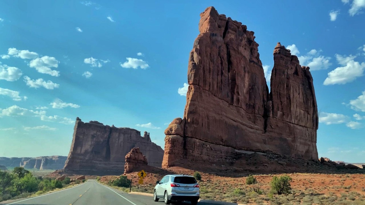
Writers who track risky routes now group these roads into global lists of Dangerous Road Trips Across the US for Brave Travelers and beyond, highlighting places like the Million Dollar Highway in Colorado alongside international legends. Photographers such as Carol Highsmith capture the beauty that keeps people coming, even as local drivers quietly adjust their schedules to avoid the worst stretches. On the ground, residents know that the most intimidating mountain roads do not just challenge tourists, they shape daily life in communities that live in the shadow of those cliffs.


Leave a Reply