
Powerful Atlantic surf has again exposed the fragility of North Carolina’s barrier islands, ripping apart a key stretch of highway and leaving an estimated 1,000 people cut off on the Outer Banks. As storm surge punched through dunes and swallowed pavement, the collapse of the road turned a familiar vulnerability into an immediate crisis, stranding residents, workers, and visitors on a narrow ribbon of sand. I see in this failure of asphalt not just a transportation problem, but a stark preview of how rising seas and repeated storms are reshaping where and how coastal communities can safely live.
The night the pavement disappeared
By the time the latest Atlantic surge peaked, the warning that “the road’s gone” was not hyperbole but a literal description of what had happened to a long, exposed section of Highway 12. Storm-driven water pushed across the beach, overtopped the protective dunes, and then poured over the asphalt until the highway itself disappeared under churning surf. Video from the Outer Banks shows waves cutting straight across the barrier islands, with the former roadway reduced to broken edges and sand-filled gaps where cars had been driving only hours earlier.
That sudden loss of pavement instantly trapped roughly 1,000 people on the islands, because when Highway 12 and the ferries shut down no one can enter or leave. The isolation is not just inconvenient, it exposes how fragile daily life is on these barrier islands, where a single corridor carries everything from groceries and fuel to emergency services. In earlier storms, transportation officials had already been battling overwash and closures along this same route, discussing what they need to do to make it more resilient or even relocate it to a higher area. The latest collapse shows that the ocean is now testing those ideas faster than planners can act.
A community stranded on a sandbar
For those stuck on the wrong side of the break, the highway failure turned a familiar storm into something more unsettling. Residents who have long accepted overwash and detours suddenly found themselves living on what felt like an island within an island, with no clear timeline for when the road would reopen. I imagine parents weighing how much fuel to burn on generator power, small businesses watching perishable stock spoil, and older residents wondering how an ambulance would reach them if something went wrong while the pavement remained impassable.
The Outer Banks have always been a precarious place to build a life, but the current isolation underscores how that risk has intensified. Earlier storms had already forced closures of N.C. Highway 12, limiting response and cleanup operations when homes collapsed into the ocean in communities like Rodanthe. Local leaders have warned that the Buxton area has suffered catastrophic shoreline collapse and that local governments cannot effectively respond without state support. When a single storm surge can erase the only road and leave 1,000 people stranded, the line between a scenic tourist destination and a disaster-prone sandbar becomes uncomfortably thin.
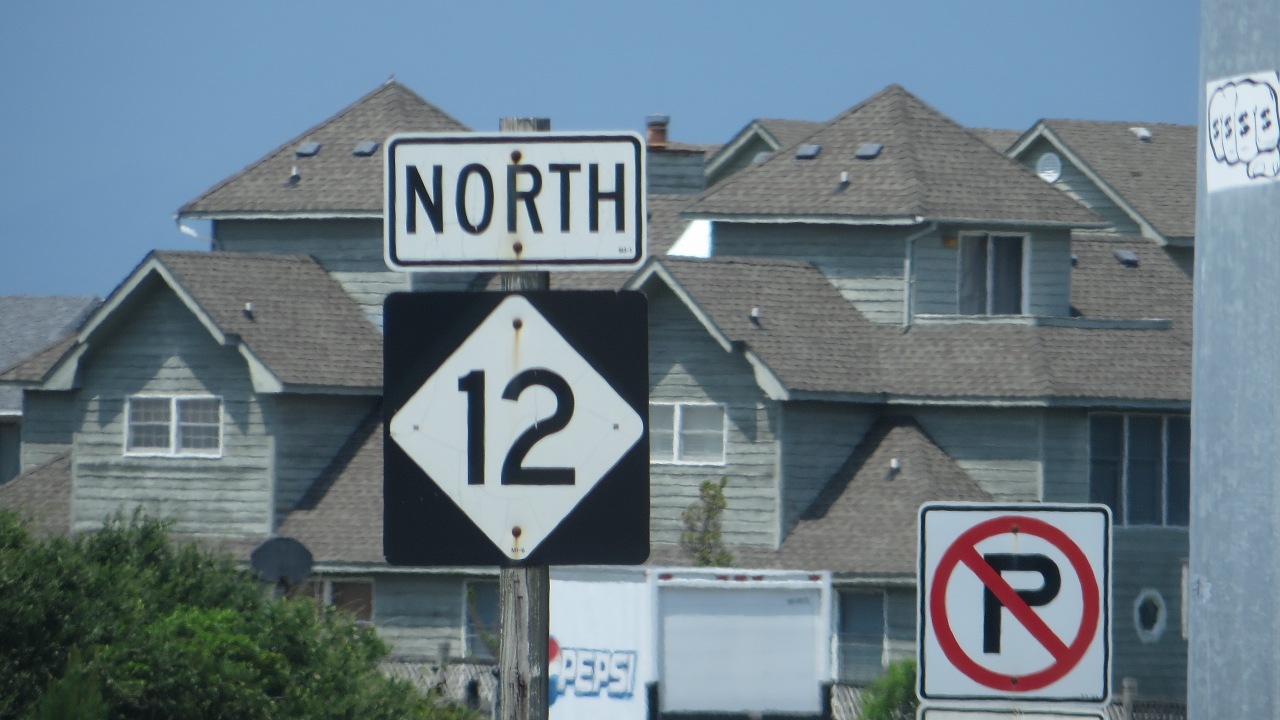
Highway 12’s long fight with the sea
Highway 12 has been losing ground to the Atlantic for years, and this latest collapse fits a pattern rather than an anomaly. The road threads along some of the narrowest parts of the Outer Banks, often with only a few yards of sand between asphalt and surf, and every major storm rearranges that sand. Transportation crews have repeatedly pushed dunes back into place and rebuilt washed-out sections, only to see the next nor’easter or hurricane carve new channels across the pavement. Earlier coverage of closures along this route described an ongoing battle with overwash, with officials openly debating whether the highway needs to be raised or shifted inland where possible.
Even before this most recent failure, engineers and coastal scientists were asking whether North Carolina Highway 12 can survive amid rising sea levels. The road has been described as iconic, but also as a piece of infrastructure that was never designed for the pace of shoreline change now underway. On other stretches of the Outer Banks, homes have already collapsed into the ocean, with cleanup efforts hampered when N.C. 12 is closed by severe weather. When I look at that history, the image of an entire highway disappearing under storm surge feels less like a freak event and more like the logical endpoint of a long, losing contest between asphalt and a moving shoreline.
Rising seas and a vanishing coastline
The collapse of the road is inseparable from the broader story of how the Atlantic is reshaping the American coast. Recent findings show that sea levels along parts of the Atlantic seaboard are rising faster than the global average, increasing the risk of chronic flooding for tens of millions of people. On the Outer Banks in North Carolina, that rise is layered on top of natural erosion, so each storm starts from a higher baseline and has less dune and beach to chew through before it reaches critical infrastructure. When powerful winds and storm surge overwhelmed the islands in late October, the water did not have to work very hard to find the weak points.
Video from earlier in the year captured how sections of the Outer Banks are already disappearing, with long stretches of beach narrowed or broken by new inlets. In Buckton North Carolina, a strong nor’easter drove erosion that ate away at the shoreline, offering a preview of what repeated storms can do when they arrive on top of elevated seas. The fact that homes in Rodanthe have collapsed into the ocean, six since one recent spring, is another sign that the land itself is retreating. I see the vanished highway as part of that same retreat, a visible scar that traces where the ocean has advanced inland and where human construction has failed to keep pace.
Politics, planning, and the limits of patchwork fixes
Behind the broken pavement lies a political and planning challenge that North Carolina has struggled to confront directly. Regional leaders like Hanig have already urged the governor to declare a state of emergency for NC 12, arguing that communities such as Buxton cannot effectively respond to catastrophic shoreline collapse without state support. Transportation officials have talked about making the road more resilient or moving it to higher ground, but those ideas run headlong into the realities of limited budgets, private property, and the sheer speed of coastal change. Each time crews truck in more sand or rebuild a washed-out lane, they are buying time rather than solving the underlying problem.
As I weigh the images of a sunken highway and stranded residents, it is clear that the Outer Banks are a test case for how far patchwork fixes can go in an era of rapid sea level rise. The Atlantic is not waiting for long-range studies or funding cycles, and the people who live and work on these islands are the ones who pay the price when the next surge arrives before the next project is finished. The question now is whether state and federal leaders will treat the disappearance of this road as a turning point that forces a more candid conversation about relocation, managed retreat, and what it really means to keep a community safe on a narrowing strip of sand. Until that conversation becomes policy, I expect the ocean to keep writing its own plans in the broken lines of Highway 12.
More from Fast Lane Only